Europe's most famous mountain range, the Alps, begins on the Mediterranean coast of France near Nice, and then stretches through Switzerland, Italy, the former Yugoslavia, Germany and Austria, ending in the Danube Plain.

In the heart of the Alps stands Mont Blanc, a mountain and a mountain range stretching for 50 kilometers. The official height of Mont Blanc is 4,810 meters, although this is not stable. Between 2003 and 2007, the height rose by 55 centimeters, and then over the next two years it decreased by the same amount. The latest calculations, made by French experts in 2015, gave a result of 4,808 meters.

Such deviations from the “norm” are caused by the movement of rocks and the melting of ice. And despite all this, Mont Blanc remains the highest point in Europe.
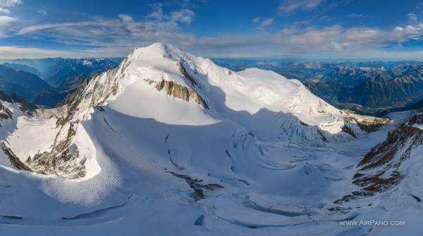
However, this parameter is also taken into account differently. The fact is that the famous 5642-meter Elbrus is located on the border of Europe and Asia; and when it is attributed to Asia, Mont Blanc takes the first position in height in the European ranking. In the case of Elbrus being attributed to Europe, Mont Blanc drops to second place.
This elevation also lies on the border, dividing France and Italy. From both languages (Mont Blanc and Monte Bianco) it is translated as “white mountain”. The countries still cannot divide this majestic natural monument. Once Mont Blanc was entirely located on the territory of the Duchy of Savoy, and since 1723 – the Kingdom of Sardinia. During numerous subsequent wars, these lands went to one side or the other, until in 1861 another agreement on demarcation of borders was signed, and Mont Blanc was named the border line of France and Italy.

The act and attached maps from that time still have legal force for both countries. However, with the development of tourism, each of them wanted to get the most advantageous parts of the mountain. Things got to the point of curiosities: in the summer of 2015, representatives of France and Italy kept independently moving the mark by 100-150 meters, including using a bulldozer.

The first mention of climbing Mont Blanc dates back to August 8, 1786. Since then, the cities closest to the mountain – Italian Courmayeur and French Chamonix – have been working to serve the thousands of tourists who come here for mountaineering and skiing. Since 1965, you can drive through an 11-kilometer tunnel under Mont Blanc, getting from one country to another. Every day, the Mont Blanc tunnel passes more than 5,000 vehicles.

Another outstanding peak of the Mont Blanc massif is the 4,465-metre Mont Maudit, which separates the French region of Rhône-Alpes from the Italian province of Valle d'Aosta. According to legends dating back to the Roman period, spirits and demons lived in these steep gorges, pushing ice blocks to the foot of the mountain, and witches danced on its summit. The English traveller and cartographer William Wyndham, who explored this mountain region at the beginning of the 18th century, was greatly impressed by the ancient myths, and thanks to him, until the end of the century, the summit and its secondary peak were known under the common name Montagne Maudite: "Cursed Mountain".
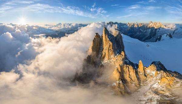
The name of the 3,842-metre mountain Aiguille du Midi means “midday peak” in French: at exactly midday, as seen from Chamonix, the sun is directly over its summit.

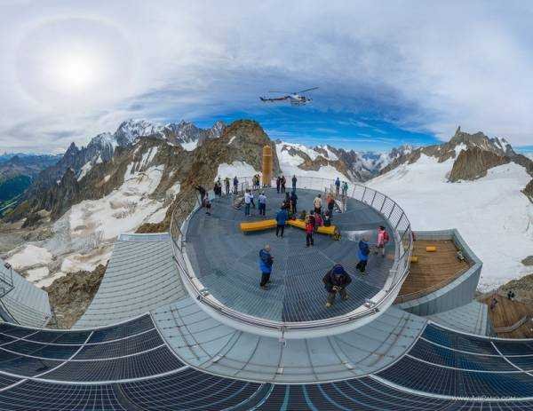
One of the most beautiful and most difficult to climb in all the Alps is considered to be the peak of Petit Dru: 3733 meters. And in total in this mountain range, lying on the territory of three countries - Italy, France and Switzerland - there are 57 peaks, the smallest of which has a height of 2,374 meters. And although not all of us are capable of mountaineering feats - now you can visit these mountains without leaving home, with the help of our panoramas.
Source: travel.ru


